Randall
St John’s Azores Leg
Day 1
Monday, June 15
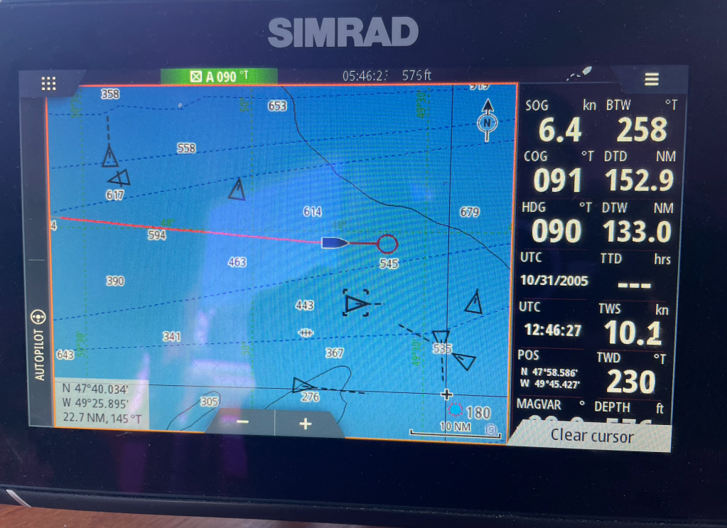
Noon Position: 47 58.6N 49 38.1W
Wind: S to SW at 9 – 13
Course: E
Pressure: 1022mb
Noon Miles: 150
On the afternoon of departure, Conception Bay had hit temperatures in the high seventies, so it was with some surprise that as the day of our departure waned and we reached further out to sea, so we also reached for more and more layers until, hours later, when there were stars above, I was clad in a wool cap, a down jacket, long johns, wool socks and insulated boots—and I was still COLD. Cabin temperatures sank to 41 degrees overnight (there is no heater to be had while sailing) and the sea, 36.
As we push east, we are crossing the Grand Banks, a large shelf of shallow water (avg. depth 500 feet), home of the historic cod fishery. Many an old Newphie we met at the bar has told us that the fishery is long dead, victim of its own success and the fish’s prudish refusal to speed its reproductive cycle. But you wouldn’t know it by the number of commercial fishing boats we encountered as we cross. Though we saw only a couple by eye, the AIS screen captured as many as eight at a time, with names like Eastern Princess, Royal Gannet, Atlantic Express, Killer Maiden, and Newphie Wonder.
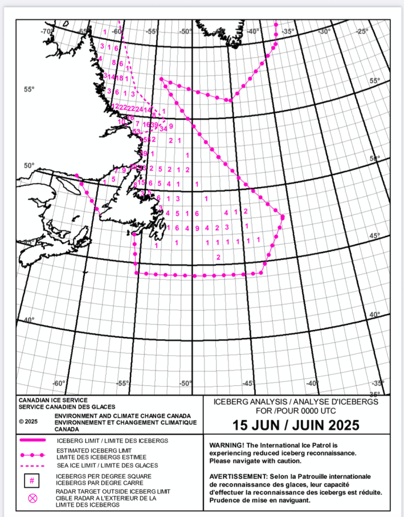
Also, we have thus far seen exactly zero icebergs, this though Environment Canada states there are roughly a hundred in the waters east of Newfoundland. Bergs on this coast have come down from Davis Strait. The actual route can be quite long, that is, down the east coast of Greenland, around the bottom, up the west coast of Greenland, around Melville Bay, and down the Baffin and Labrador coasts on a trip that can take years. Most, however, probably originate near Disko Island on Greenland’s west coast. According to locals, sometimes these bergs and attendant pack ice will fill Conception Bay utterly full of ice. Not this year.
In the below chart, pink numbers are the bergs per degree square; at this latitude, that’s a square approximately 40 miles wide and 60 miles tall. Our course in the below graphic is roughly through the number sequence 1, 6, 4, and 9. And thus, it’s a testament to the ideas of size and scale that there can be so many near us and yet so few to be seen. Evidence to the contrary, we are encouraged to keep looking (and to fly by radar at night) as the Titanic’s resting place is not far to the south.

Leave a comment