Leg 5, Blog 2, March 29
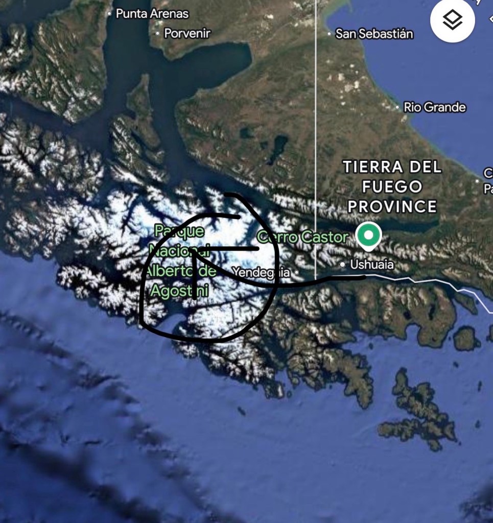
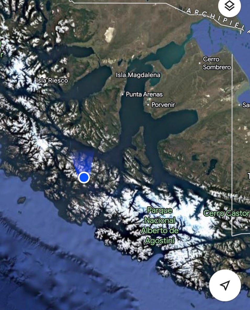
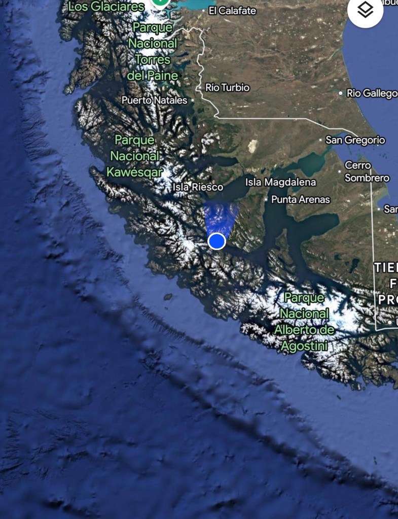
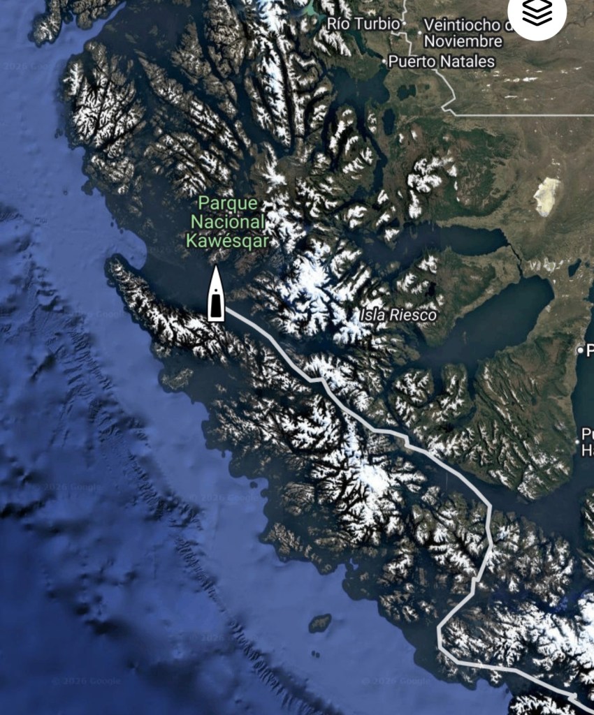
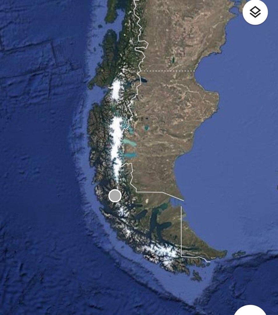
As you can see above, we have, as of March 18th, now left the (the southerly most route being the Beagle Channel) and are transiting our way northwest to the Strait.
For commercial traffic, the Strait of Magellan is primarily chosen over the Beagle Channel (or rounding Cape Horn) because it offers a safer, more sheltered and wider passage (for larger ships) navigating between the Atlantic and Pacific oceans, avoiding the extreme turbulence of the open sea. It serves as a direct and efficient route, boasting no speed restrictions in certain sections (not our problem!)
According to my AI friend and seconded by Randall, the Strait of Magellan is often preferred because it acts as an inner passage that is more protected from the dangerous, high-pressure, and stormy conditions of the Drake Passage and Cape Horn.
So there you have it, three choices for rounding the cape. For those who choose not use the Beagle or the Strait, they should stay way off shore . Most people who die rounding the Cape get too close to shore on the Pacific side and get swept into the west coast of lower Chile during a storm. It’s ok to have the Horn within eyesight when rounding but keep the lower third of the west coast of Chile several hundred miles away!
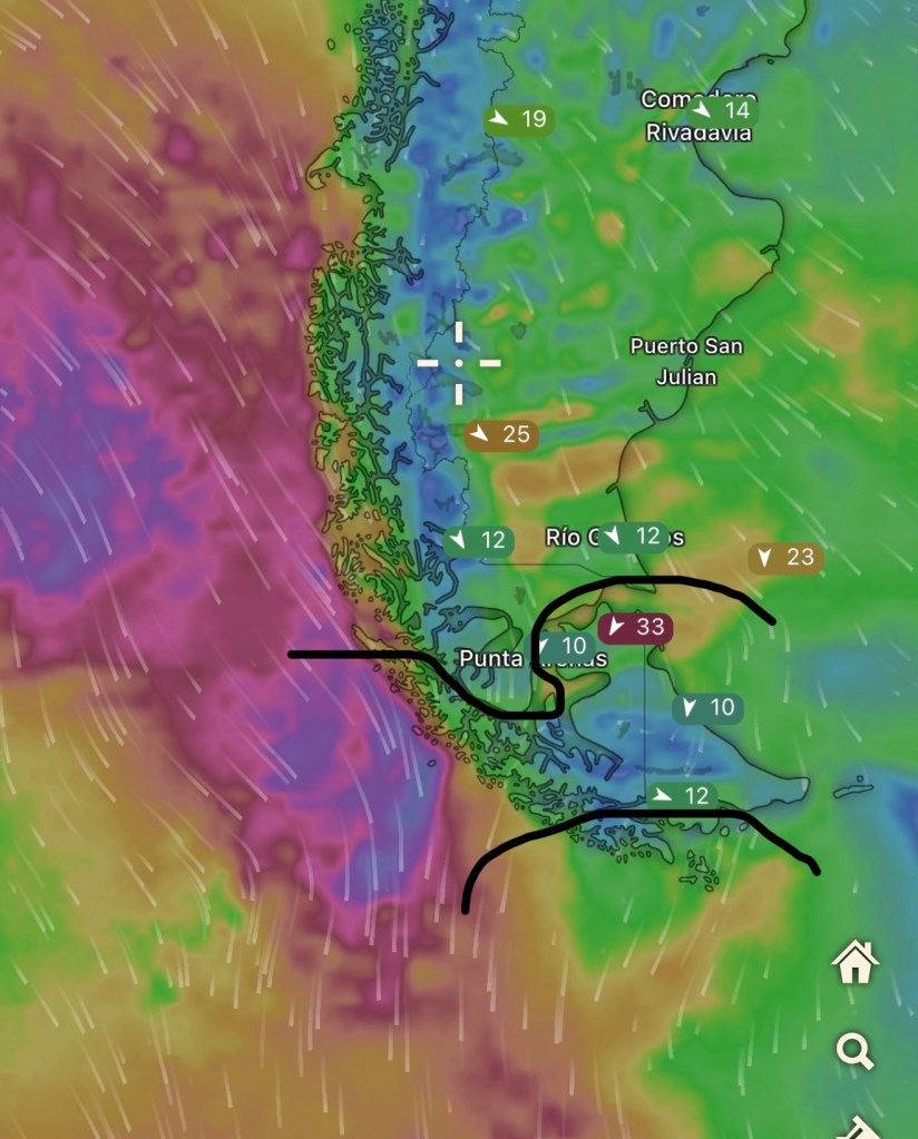
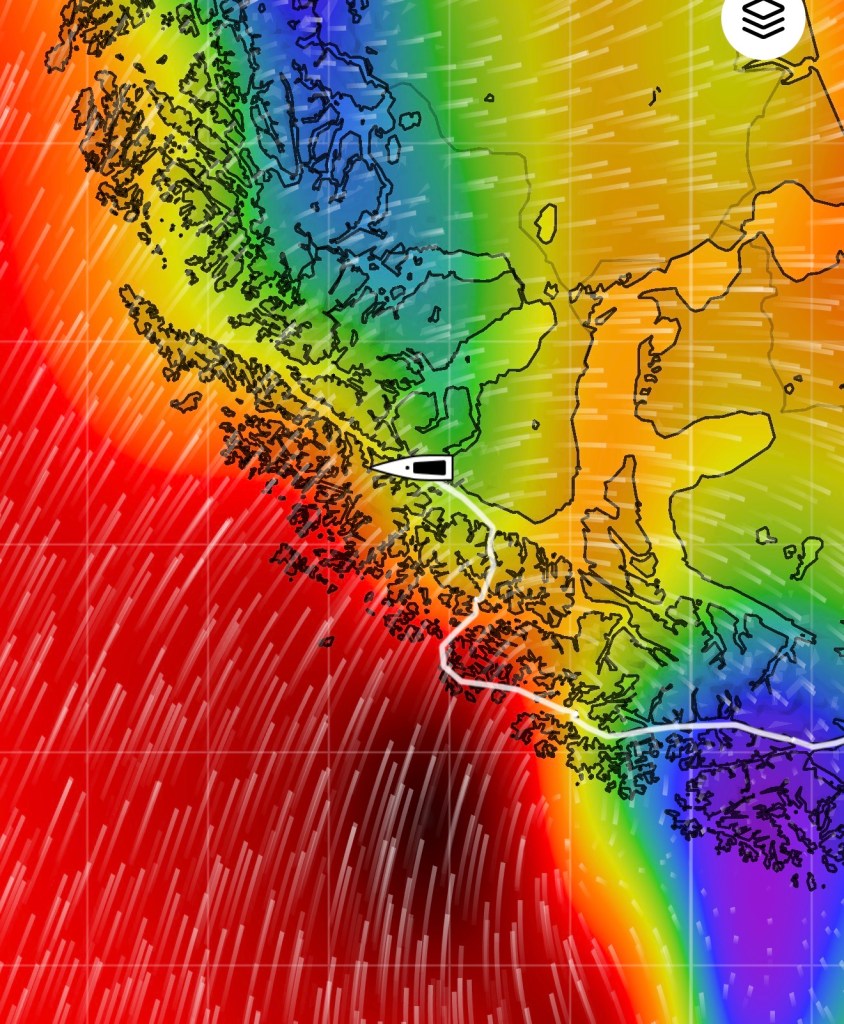
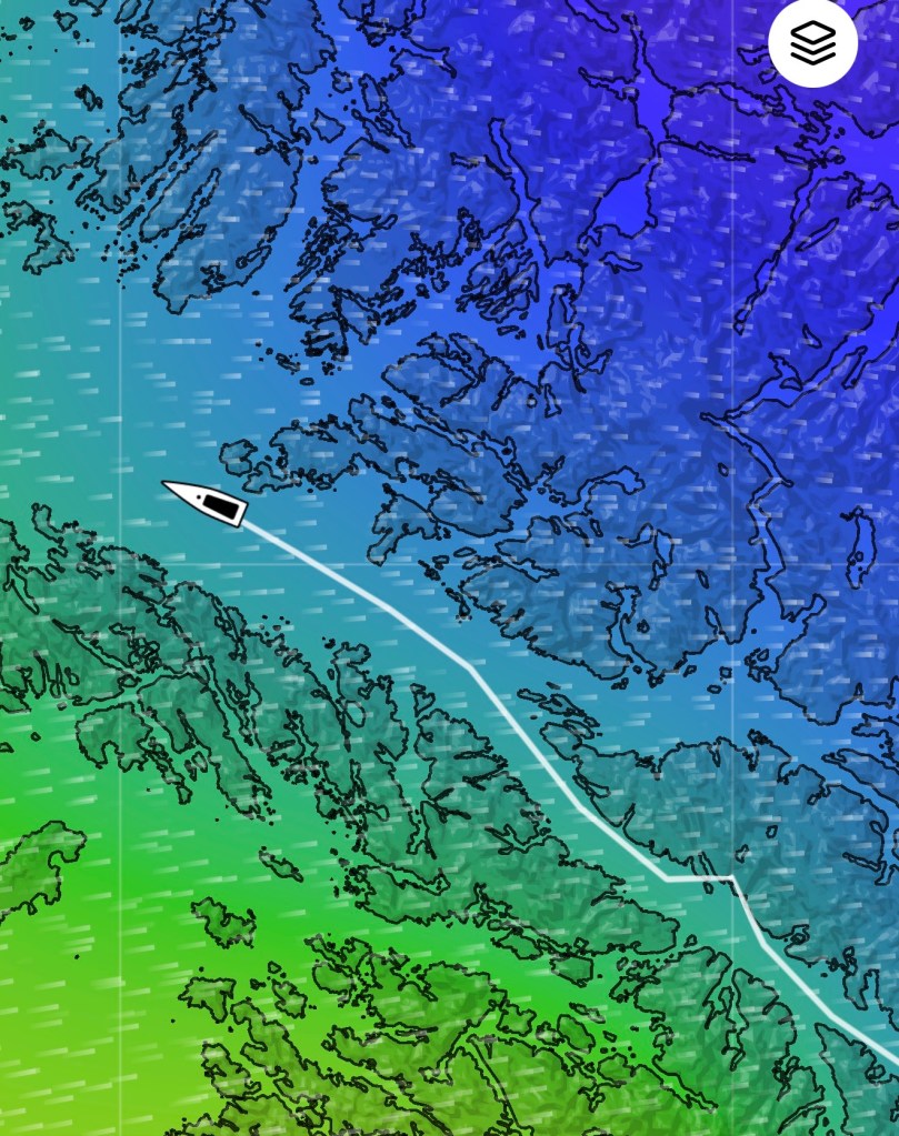
Above: For fun, I uploaded today’s weather and drew in the Beagle Passage (lower) and the Strait of Magellan (upper) Both are largely protected (kind of, for now) against the raging storm in the southern pacific (purple means 45+ knots). For our purposes, we want to stay on the inside passage for as long as we can, seeking its protection from the massive wind storms (cyclones) and offering us refuge at night as we seek shelter.
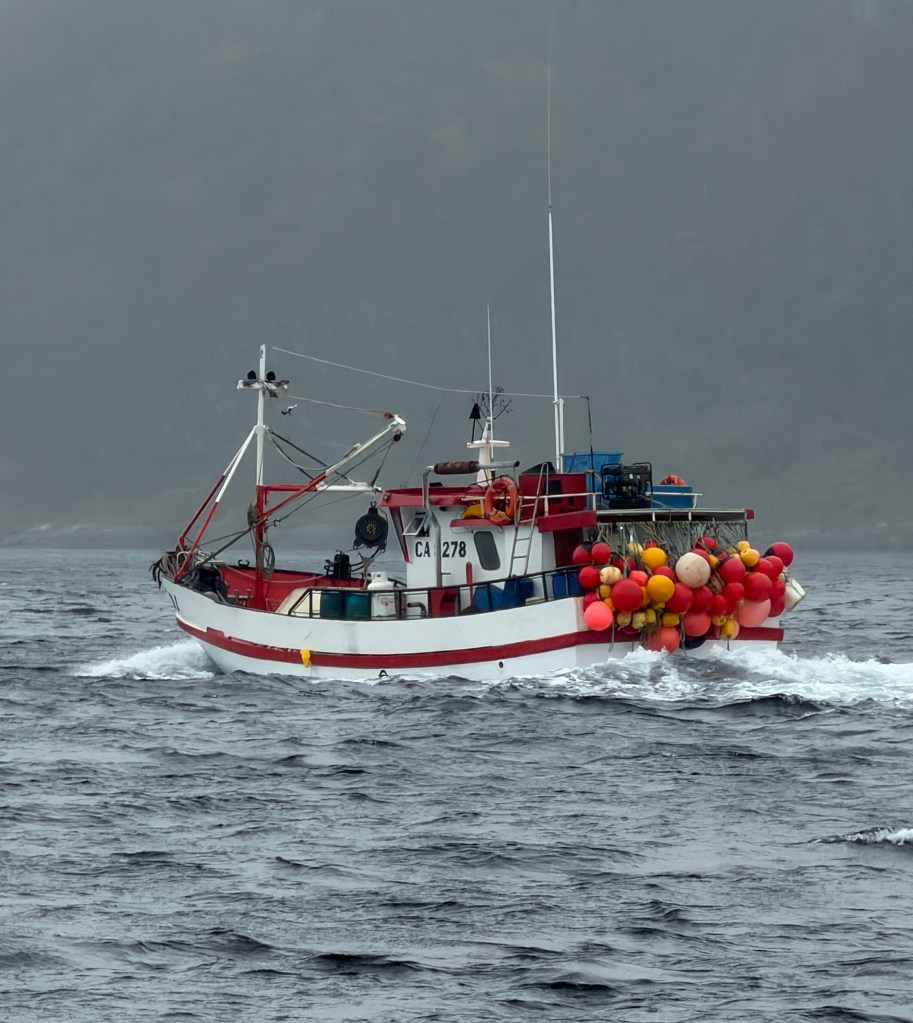
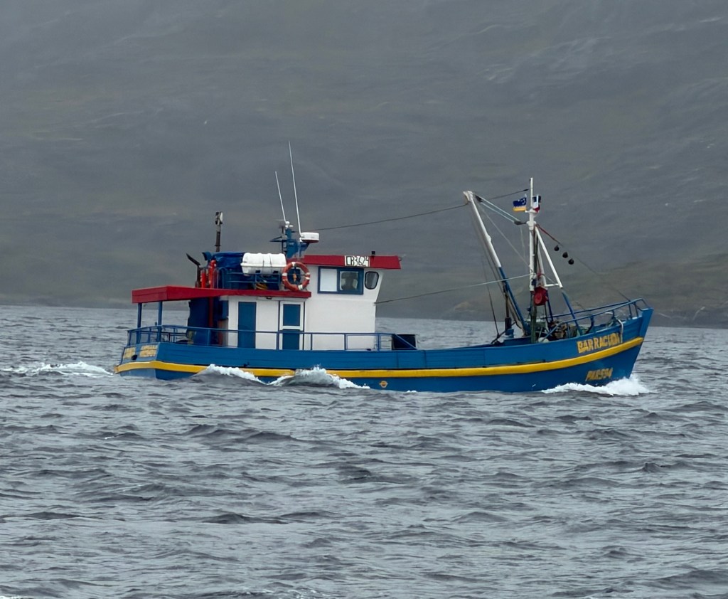
As we transit into the bigger channels between the Beagle and the Strait, we begin to see some lonely commercial traffic including these colorful fishing boats. Randall and I have no Idea what they are fishing for, and they seem to be in transit rather than pulling in fish at this time.
Above: Swedish colors!!
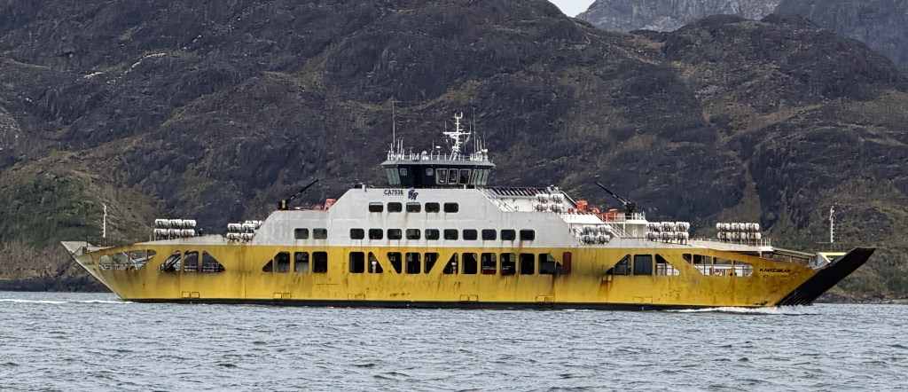
Above: Harkening back to days of yore (before rudimentary roads), the Punta Arenas to Puerto Williams ferry https://www.tabsa.cl/rutas/parenas-pwilliams/ferry was in its heyday. Back in the 1990’s the ferry was almost the only way to get across the Strait from the mainland to the island of Tierra del Fuego. I say “almost”, because wife Jorun and I were in Punta back then, and did not have the patience to wait for the two times a week ferry. So we joined a two mile long line of trucks, and calmly (me anyway) waited for a WWII landing craft that operated 24 hours a day to ferry us across the Strait from one remote beach to the next on the other side. We finally got our turn to load at 3:00 AM as we were packed in with massive trucks as we drove on board.
The 45 minute crossing was brutal as the waves crashed on board as the landing craft rocked and rolled and the trucks came within inches of falling into our rented Jeep. We drove off into Tierra del Fuego at 4:00 AM with little gas, little cash, and we noticed that the next city was hundreds of miles away with no civilization (i.e., gas station or ATM!) in-between. We did find a boarding bunk house filled with oil workers, but at 5:00 AM they were fast asleep and snoring so loudly that they did not notice us as we casually walked through their wide open bunk rooms looking for a spare bed (there were none). We drove on a few more miles and realized that this was as far as were going to make it. We “slept” for a couple of hours in our seats, and made it back to the landing craft and arrived in Punta that next afternoon. The ferry, in retrospect, would not have been a bad way to go.
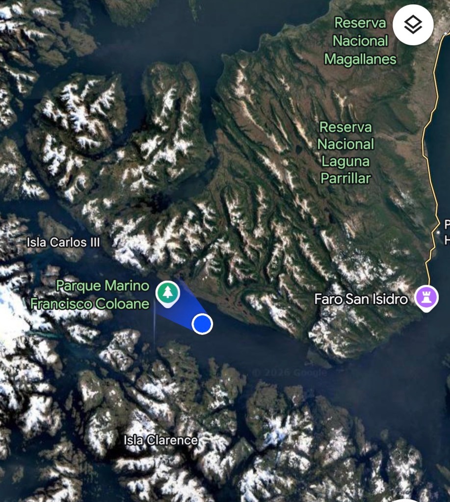
Night 3: Caleta Cluedo (Night of 3/19)
Caleta Cluedo is a large, long bay on Isla Clarence. It is noted to be one of the best anchorages. because it is so protected from the north wind and we can find easy spots to tie into. We set anchor at 7:30 after a roughly 11 hour, 69 mile passage.
What a beautiful and calm welcome after a long rough day.
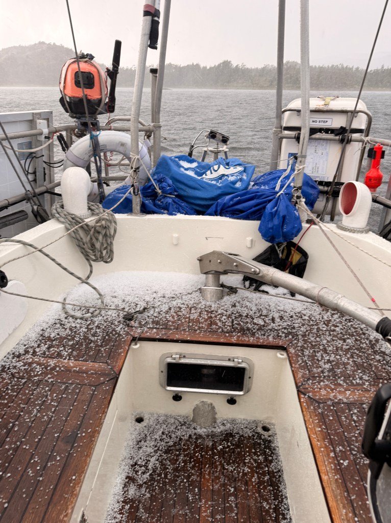
The weather was quite cold as we pulled in. That night, we would wake up to temperatures in the 30’s, and with a slippery iced deck.
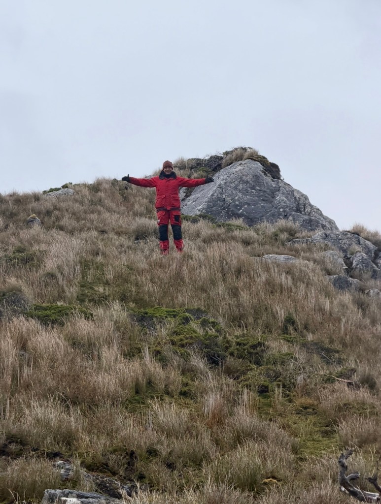
Above and Below: It is always fun to take the dingy ashore to get some exercise, explore the area and look at Mōli all tied and tucked in for the night.
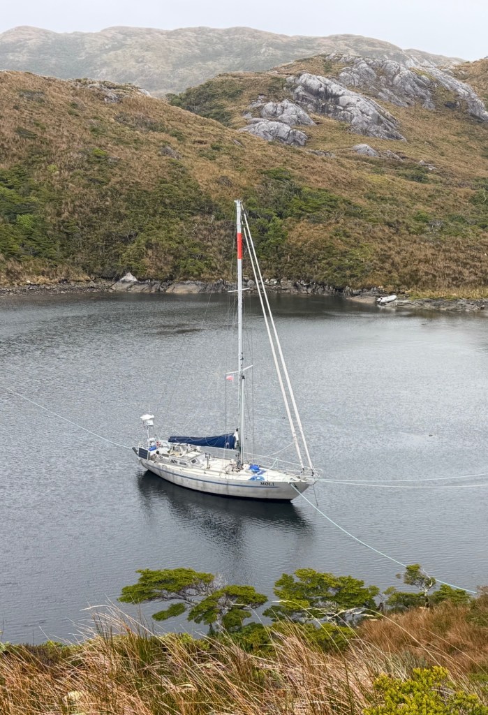
She looks good and snug to me!
Above: Our last night tucked into the canals before we entered the Strait.
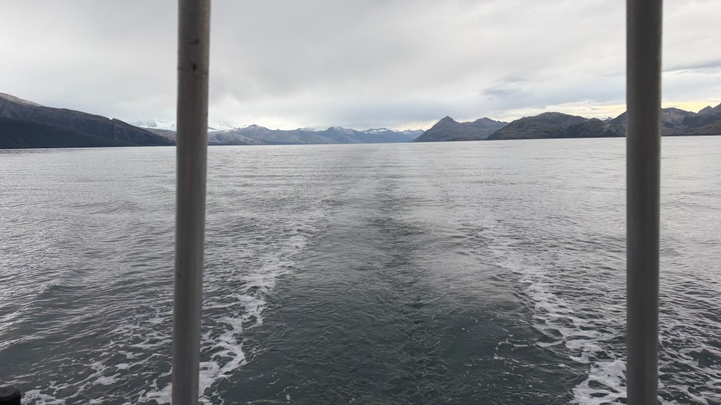
Nights 4 and 5: On our way to Muscle Bay for the nights of March 20 and March 21, we finally entered the Strait of Magellan. Wide and majestic, with occasional outcroppings of rocks filled with cormorants.
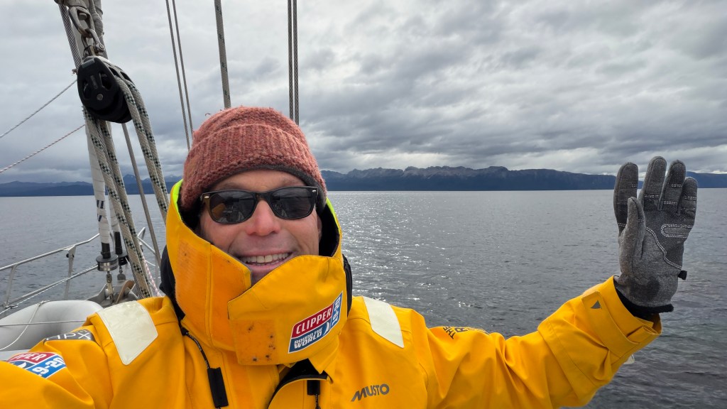
Above and Below: Feeling good to be in the Strait.
Above and Below: Yup. Mōli is dead center in the Strait. We are in big-time soup now.
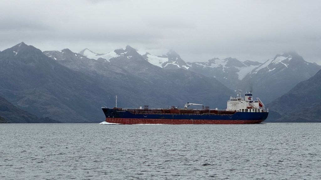
Above: In the Strait, the commercial traffic can consist of larger ships. They mostly seem to be heading to somewhere in Argentina or to Punta Arenas.
Above: The Straight is no rougher or more treacherous than any of the other passages in the area. This just happens to be when we hit a little head-wind and weather.
Above: It turned out the that after 12 hours of motoring and 51 miles made good, the night was going to be a bit rougher than we thought…
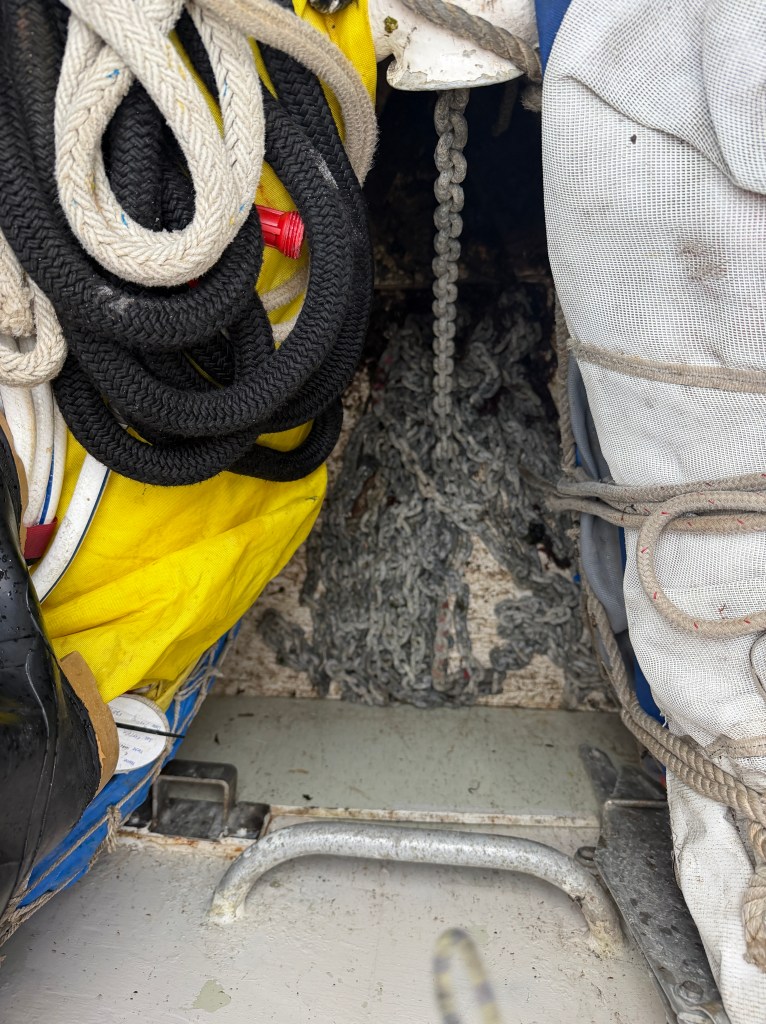
Above: Due to the wind, we let out the majority of our chain to maintain more horizontal (rather than vertical) pull. Mōli has 400 feet of chain, so you can see that we close to having 300 feet out.
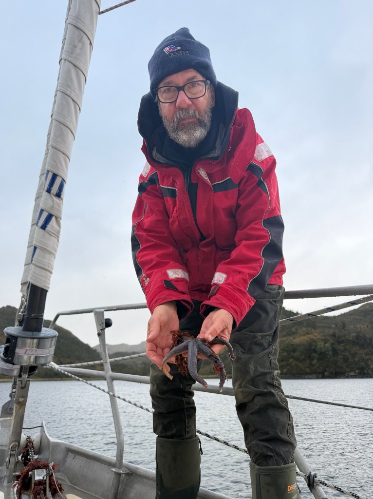
Above: As we pulled the chain back in the next morning as we were ready to go, we found a starfish who wanted to hang out for a bit to exchange stories of the deep.
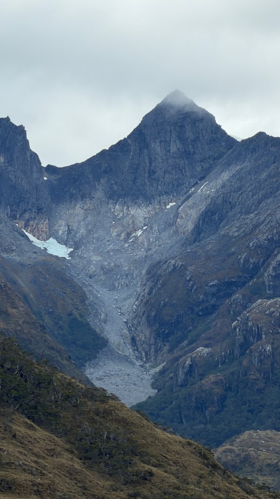
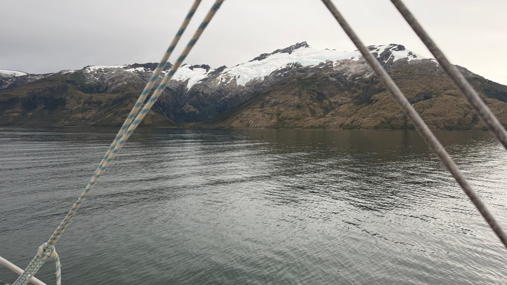
Above: Looks like the site of an old glacier….
Night 5: Caleta Playa Parda – March 21
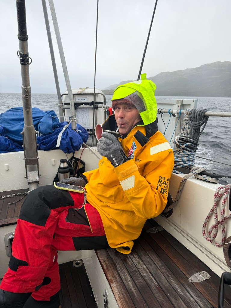
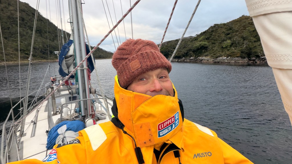
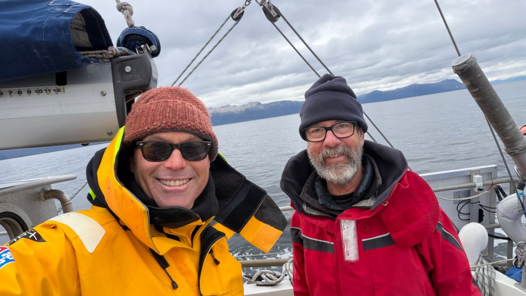
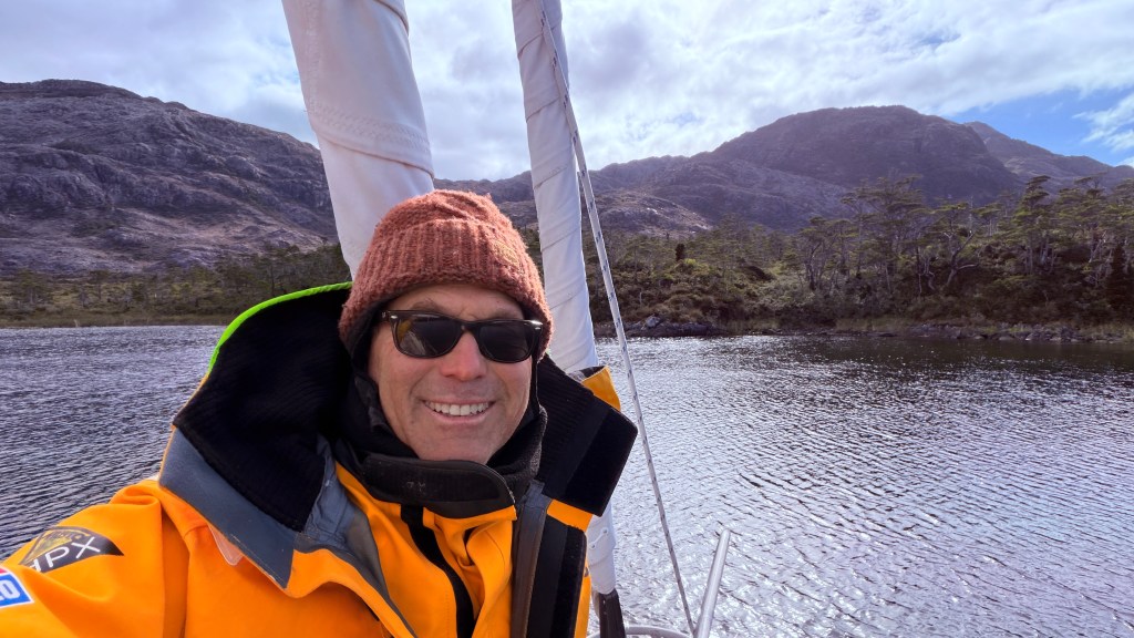
On our way the next morning, the temperature was in the 30’s, with it being wet and cold. Mate really paid off here. I’m all in.
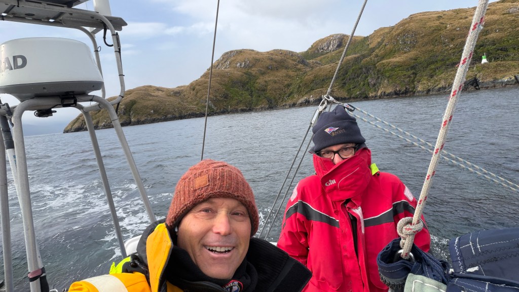
Even Randall was on the cooler side but he did not resort to mate.
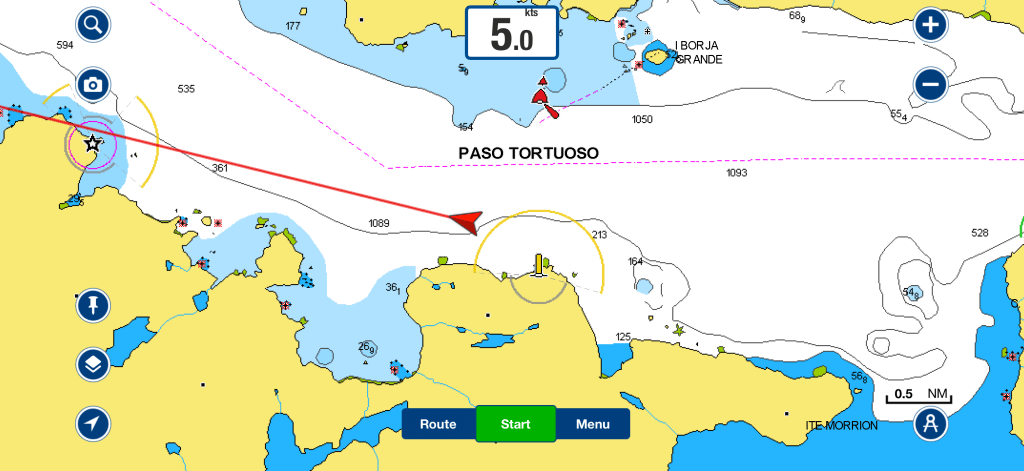
Above: You can see the chart has depth readings of more than 1,000 feet in the Strait. The most we saw was in the range of 1,200. We found that incredible. One has to sail miles past the Farallon Islands back home to go over the continental shelf to achieve those depths (and more).
Above: Randall and I debated weather these bursts of wind were rachas (Randall) or williwaws (per me). The main difference between rachas and williwaws is that rachas is a Spanish term for gusts of wind or streaks of events, while williwaws is a specific meteorological term for violent, cold winds descending from mountains to sea. Point Randall.

Above: It was getting colder and more beautiful.
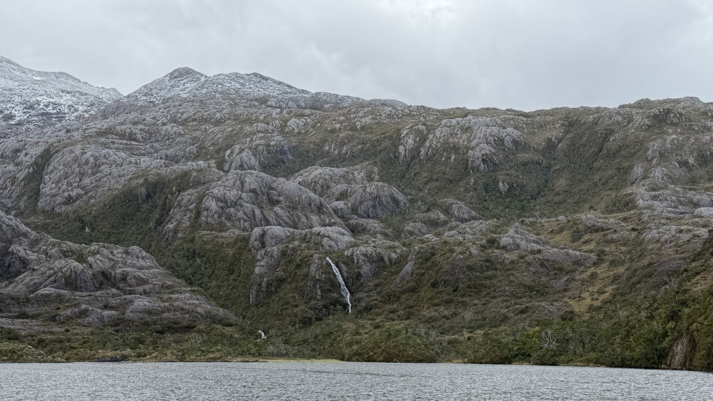
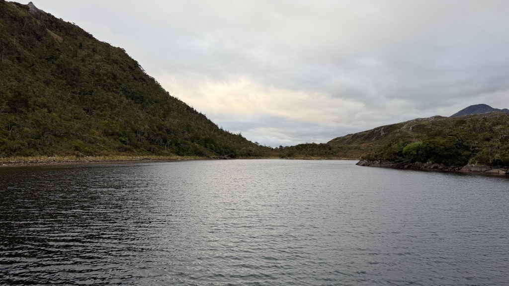
Above: After seven hours and 45 miles, we pulled into Caleta Playa Parda. The mountain streams and waterfalls were raging.

The shore was full of Southern Beach trees commonly found in regions like Patagonia and New Zealand.
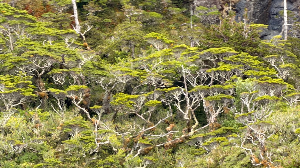
Above: These trees are known for their twisted, rugged appearance and form extensive moss-covered forests. Their natural “Bonsai” appearance looks as though they have been pruned and shaped over many, many years.
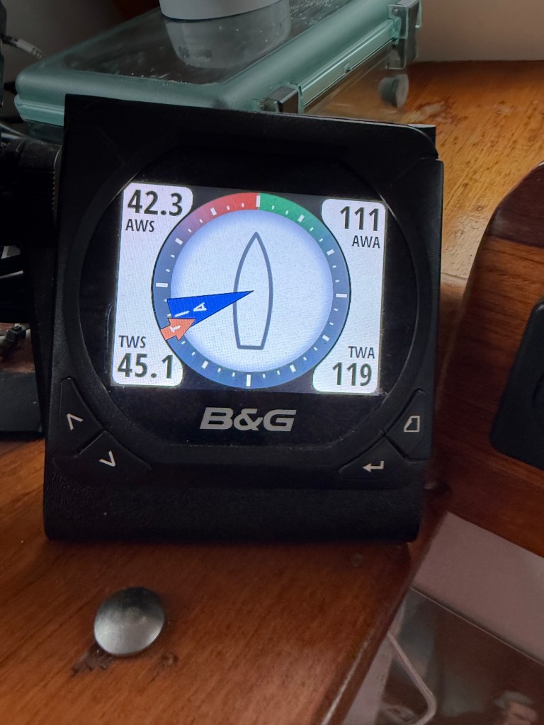
Above: That night, it gusted to 45. I mean like out of nowhere. It was blowing a cool 5 to 10 knots, and then within seconds, it was gusting to 45 knots for a minute or two, and then back to 5 to 10. Crazy. Blowing that hard just long enough to make you feel like the boat was about to be blown on shore.
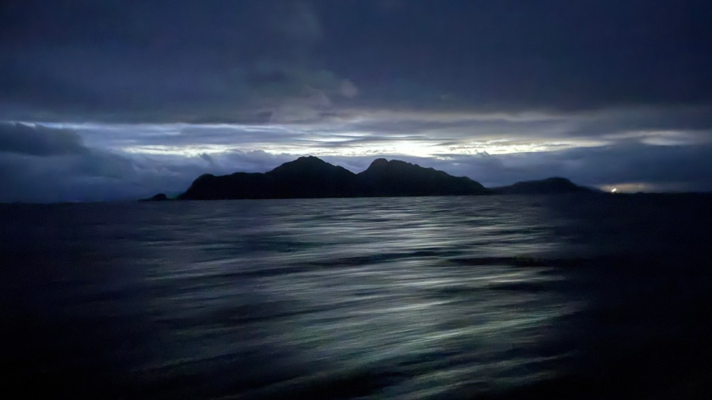
Above. We woke at 0000 (12 midnight!) to get an early start on the day….like really early! Not so hard if you go to bed at 6:00 PM and do two hour watches all night once we got going. As we did get going, it turned out to be a beautiful, clear morning.
We are just blasting through the Strait with good weather, so we keep moving! No rest for the weary.
Above: We are making good progress, but we are not yet ready to head out to the pacific ocean, so we turn more north…
Above: Pulling into Caleta Mallet after 16 hours of motoring and making 51 miles of progress. This spot is magnificent.
Night 6 – 11: Caleta Mallet Nights of March 22 – March 26.
Above: By reaching Caleta Mallet you can see that we have now left the Strait of Magellan and we will head north, until we can steal west again.
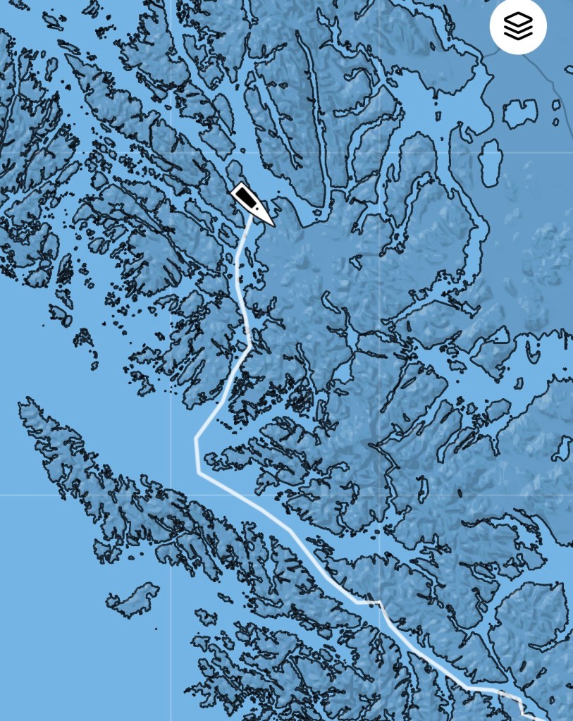
Above: We are making slow but sure progress as we make our way up the inside passage.
The first night was beautiful, but we could not help but notice that the forecast called for pain – lots of wind and rain. We were super surprised when on the first day the wind and rain picked up and all of sudden the temperature dropped and it began to hail…very hard in fact.
Above: I was ready to bring out the snow cones and build a snowman!
Then something very strange happened, the weather continued to worsen. That is not strange, but the result was that we spent five nights anchored there. The weather was so bad, and the wind so blustery that we could not leave the boat and go to land. Five days and nights adjacent to land just hanging! In some ways, it was quite peaceful and restful. Watching the weather and clock mark time.
It was all fine and calm until that second night when we were pounded by wind. This was the first time that I was at anchor in my bunk and thrown about so violently that I awoke not knowing where I was, what way I was facing, which direction we were going (nowhere!). We were doing huge up, down, left, right movements. And remember, we were at anchor!
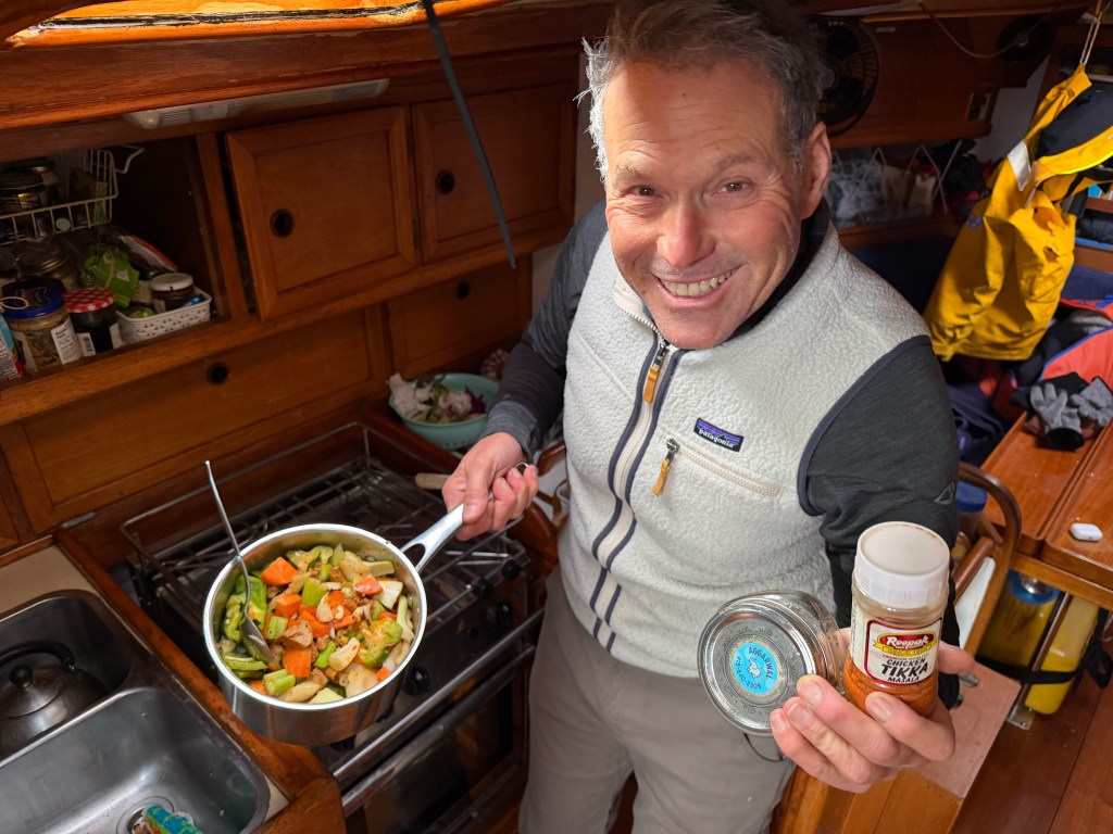
Being stuck for days gives me time to try some exotic cooking. Here I try to make a vegi-curry thanks to the Naman and Prya who stocked us with proper cloves, cardamom and cinnamon.
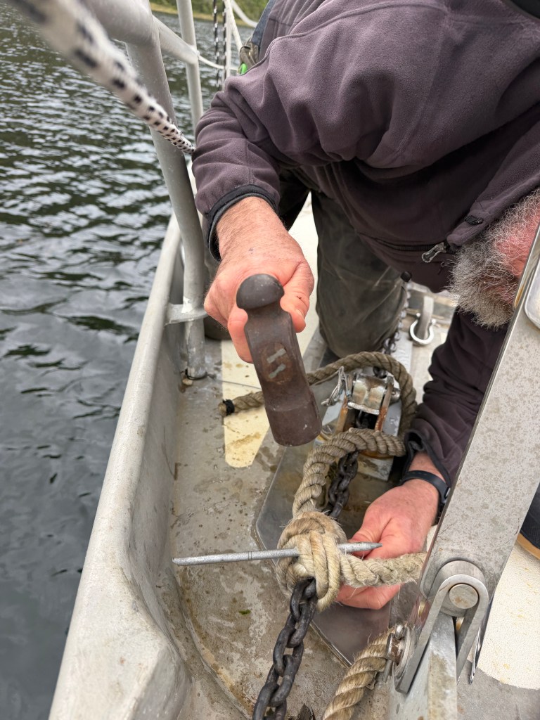
Above: On the fourth day, we thought we saw a an opening in the weather that would allow us to make our great escape. As we were ready to pull up the anchor, Randall found that there was no way to loosen the snubber line (illustrated below)
that he had attached to the anchor chain to reduce the pull. The wind had pulled us so violently that it was almost impossible to get the knot untied. With the help of a more narrow fid (antique one shown below)….

I was able to get the knot undone and off we went.
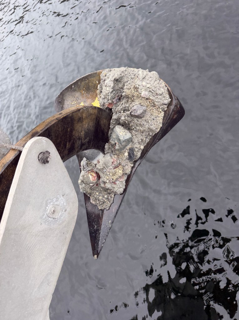
Above: Being in charge of raising and dropping the anchor has made me a connoisseur of bottom mud. Many inlet bottoms are dark and clay-like with a lot of seaweed. This cove had bottom material that was lighter in color and had some rocky mud along with a few shells.
This is shorthand to say that we made it about ten miles up the channel, and had to turn back due to intense headwinds. One more night at Caleta Mallet it shall be.
Happy Birthday to James G in NY!

Leave a comment