Leg 4, Blog 10, January 10, 2026, Latitude 64 S
Paul Heiney, in his classic pilotage book “Cape Horn and Antarctic Waters” describes Antarctic sailing in the following words:
“Sailing in the far south remains a pioneering activity. I don’t think there has ever been a cruising guide where the author can honestly say that danger lurks on almost every page. It is true that in these nervous times such books as this must issue warnings at every stage, shout out disclaimers, ring the alarm bells. The difference with this book is that we mean it.
From Cape Horn to Le Maire Strait and onward to the icebound anchorages of Antarctica. These are places for hardy sailors, not those for whom the romantic idea of high latitude sailing has eclipsed the the tough reality of it.
These waters test not only boats and gear but also the people who sail them.They will find every weakness. Sailing down here is really hard work. Your boat must become an extension of yourself and not a machine you are operating.
Before you start outfitting your boat, perhaps you might be well advised to look at yourself and see if you think that you are up for the job. Have a hard look at yourself in the mirror. Those who have to go round asking others, should perhaps venture no further”.
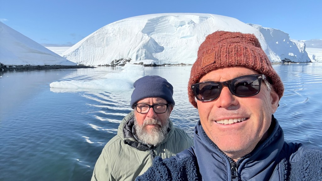
Paul wrote the above words to warn people like me to stay away. And so I did, until today. Difference being that Randall, even though this is his first time in the Antarctic (and Mōli’s second), has spent years honing his skills and knowledge enough to give us a fighting chance in the world’s only uninhabited continent.
THE MELCHIOR ISLANDS
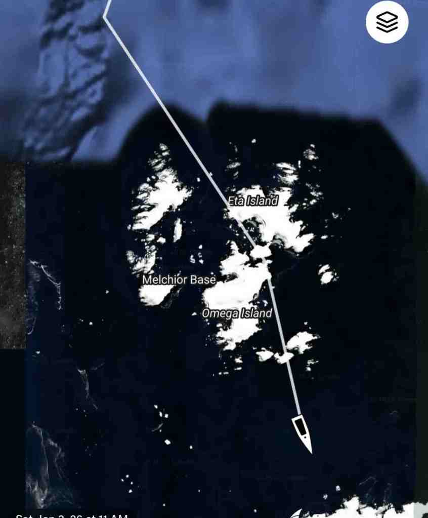
The Melchior Islands are located off the coast of East Antarctica. They were first discovered in 1820 by a British expedition led by Captain James Weddell, and one of the islands is named after Melchior of the French navy.
The Melchior Islands have become tourist favorites for those interested in visiting Antarctica’s remote regions since they are relatively easy to access compared to other parts of Antarctica due to their proximity to Tierra del Fuego and Drake Passage. They tend to be either the first or last stop in an Antarctic adventure.
The wildlife on these islands is quite diverse due to their remote location and lack of human disturbance over many years. Seals, penguins, sea birds such as albatrosses and petrels can be found here in large numbers while whales can also be spotted offshore during their migration season. In addition to these animals, there are also several species of fish including codfish, hake, mackerels, herrings, skates and rays among others.
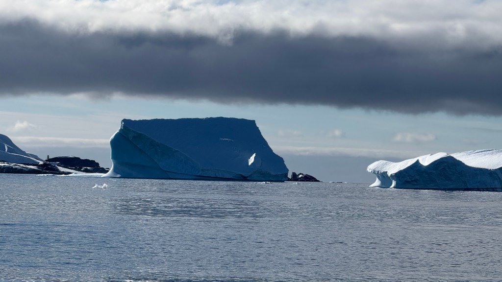
And the topography is stunning.

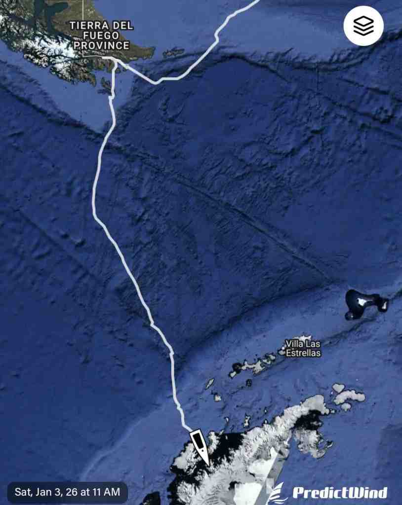
Above: On our way south getting close to our first stop in Antarctica! I took this picture just after midnight on January 2nd at close to latitude 64 S. If we had happened to be on the Antarctic circle on the winter/summer solstice on December 22nd, we would have had 24 hours of sun.
Above: Speaking of the Antarctic circle, on this trip we will not reach the line I am sorry to say (we will just have to come back!!) Our southern-most destination will be the around 64 degrees south, while the antarctic circle is at about 66.3 degrees south – another 150 miles or so. Truth is 2/3rds of Antarctic cruisers/explorers do not head that far south due to the difficulty and inaccessibility of many of the areas (i.e. ice!!)
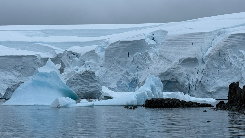
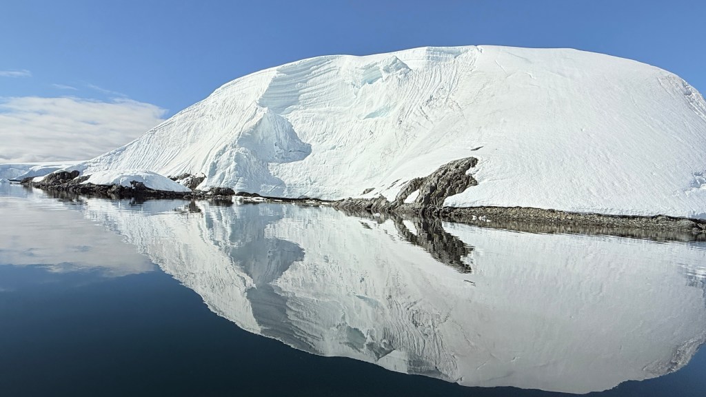
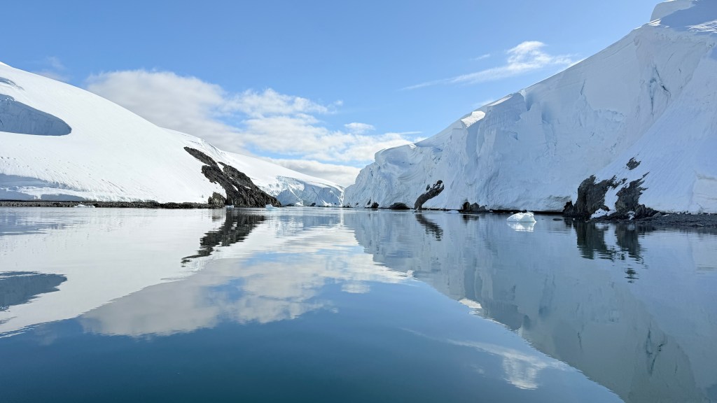
Above: Within 108 hours after leaving Puerto Williams, Chile, we arrived at our anchor point. The ice and the glaciers were just stunning and took our breath away.
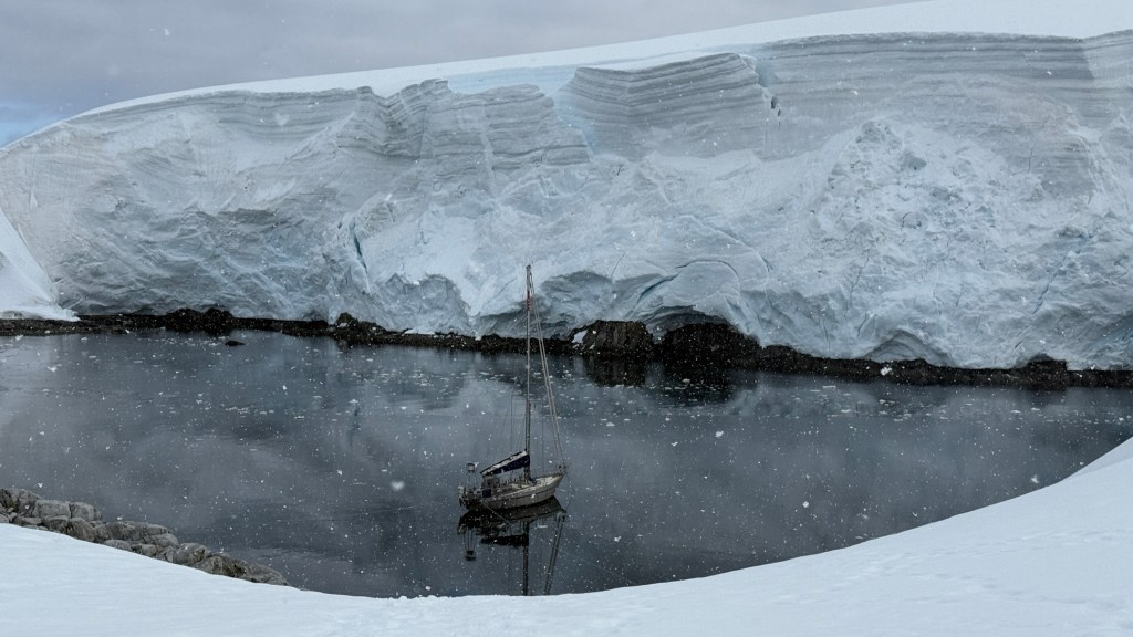
We pulled into a cove that was surrounded by massive glaciers.

Above: Even thought this is a small and remote island, we knew the best two anchor spots as Randall had studied Paul Heiney’s book. Plus Randall is in possession of a number of “secret” hand drawn maps that have been passed down from sailor to sailor that provide more detail on the anchorage. Sorry, I do not have the authority to show you these! But you can see the high level of detail of which cove to pull into, which way the boat should face and where you should set your anchor.
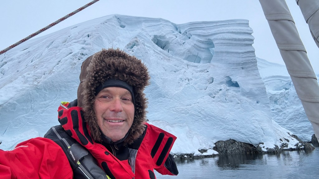
We arrived quite early in the morning, so it was extremely cold. This gave Randall and I the opportunity to put on our deep winter outfits and hats!
After dropping the anchor, first up was to inflate our dingy so we could set our lines and get ready to explore. Pumping up the dingy got our circulation going and warmed us up.

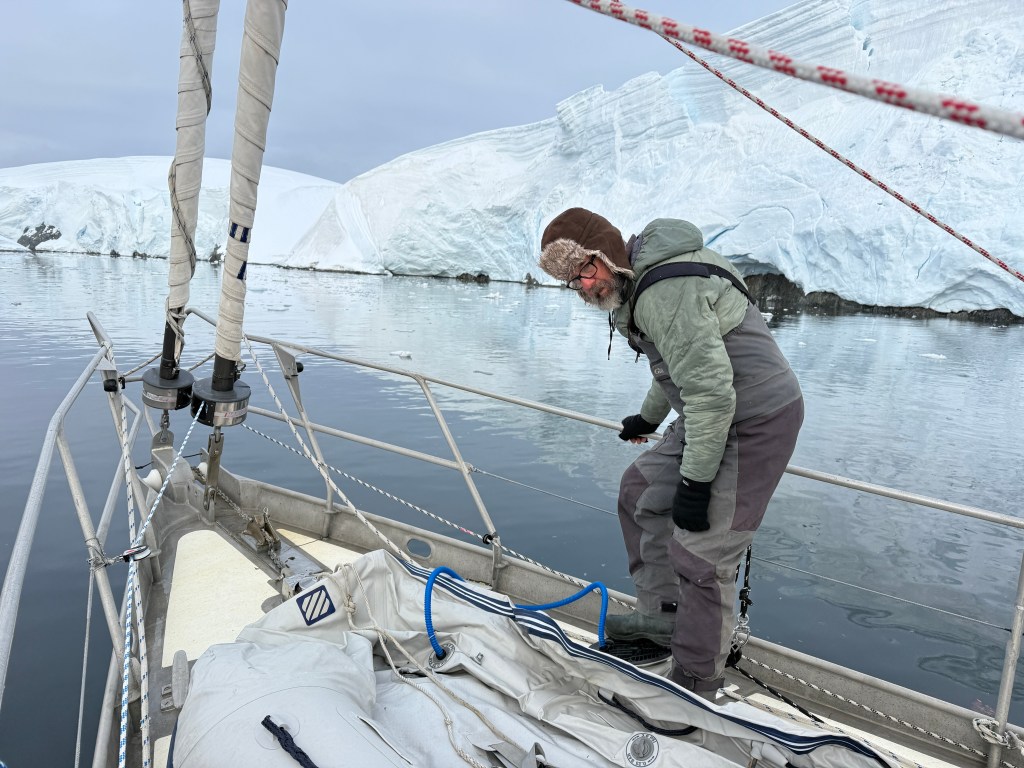
Above: After we dropped and secured the anchor, setting shorelines by tying them to a boulder is a crucial and necessary skill in Antarctica. In addition to dropping anchor, boats require one to four shorelines to secure the boat in case of the intense winds (60 mph is not uncommon) that can change direction in a matter of minutes.
Randall had prepared for this moment by purchasing multiple sets of 100 meter thick line. While some boats attach elaborate spools to their decks to hold the line, Randall had opted for keeping the lines in large sail bags.
It was my job to take the line to shore and find a big rock to tie into. Randall would stay on the boat to feed the line out and to direct me to the proper angle and potential rocks. It took me a while to develop the necessary skills to handle the dingy in freezing water, with wind and current (usually going in the wrong direction) and a rocky shoreline that insisted on finding its way to the outboard prop. It was also no easy task to find a place to land the dingy, tie it to shore so it would not float away, and then jump off the dingy and up on to the shore. At 30 degrees, falling into the water was not an option and it was necessary to keep my fingers warm to maintain dexterity.
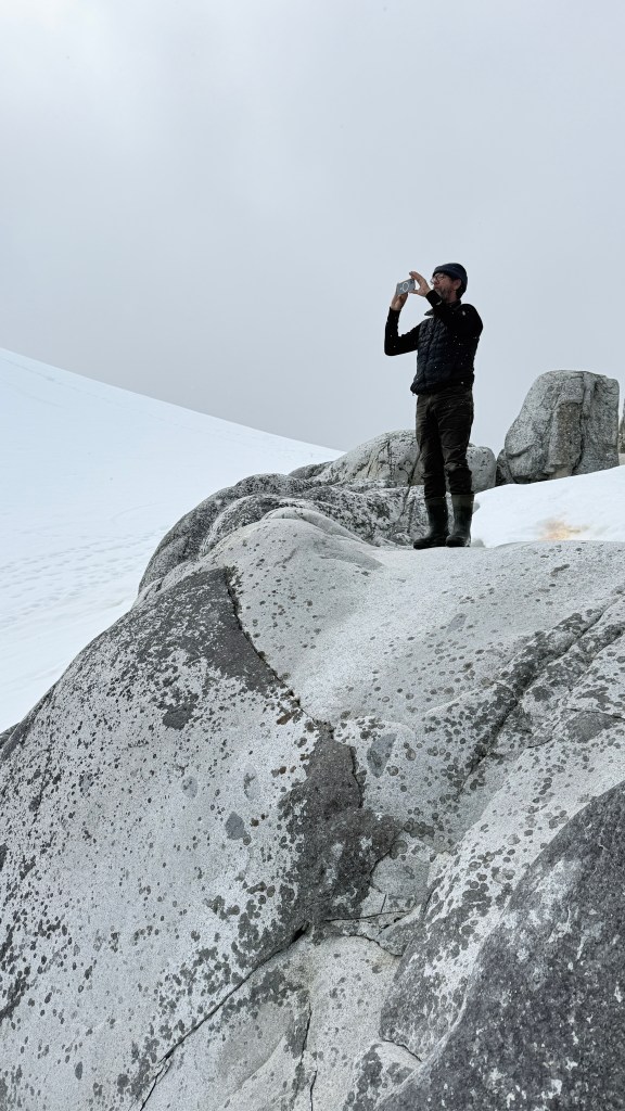
Above and Below: Once we got the boat secured, we took the dingy and climbed the nearby mountain to get a perspective on our whereabouts.

Above: As the day progressed, the sun came out and the wind calmed. I even had time to bake a modified Challah for Shabbat.
Below: Randall and I took out the dingy to do some local sightseeing.
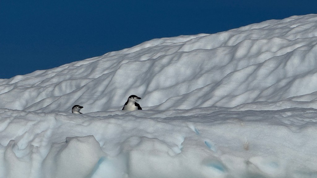
Above: On our dingy ride, Randall and I spotted our first “wild” penguins hiding from us! By wild, we mean they are out on their own and not part of a rookery (perhaps they return there at night). As you can see, these are Chinstrap penguins as evidenced by the narrow black band under their head.
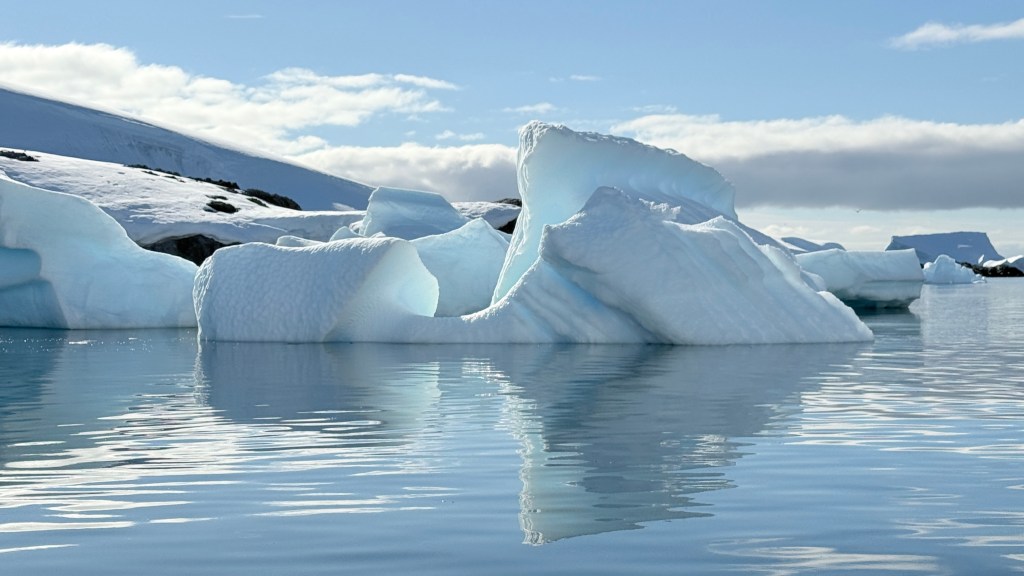
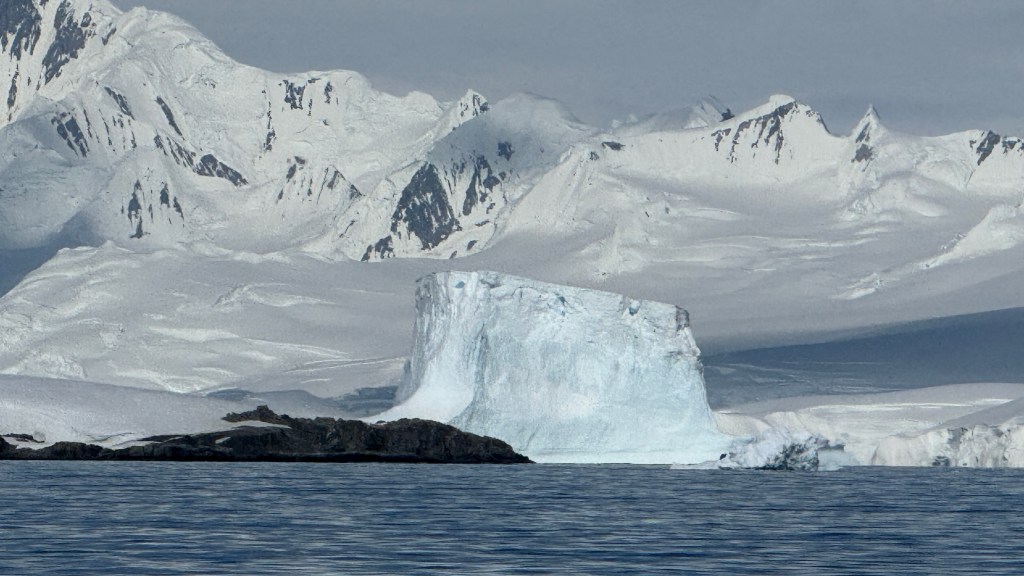
The icebergs and the scenery were stunning.
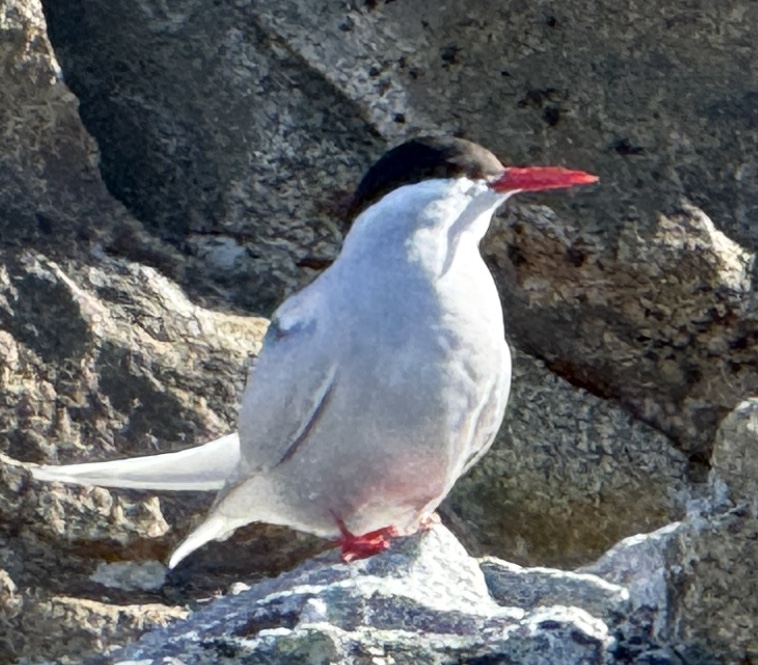
Above: Here is a friendly Arctic Tern. This species is renowned for having the longest migration of any animal, flying between its Arctic breeding grounds and the Antarctic every year (up to 22,000 miles return trip).

Above and Below: This could be a Pacific Gull (from Australia) or a Kelp Gull which are widespread across the Southern Hemisphere. They are a coastal species and rarely venture far out to sea. This gull is not happy to sea me (please see below).
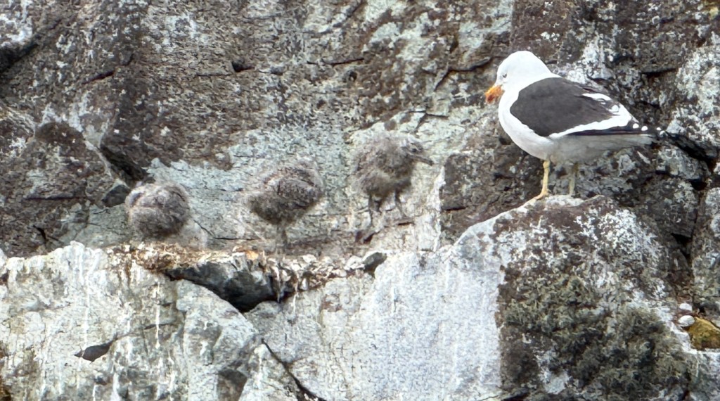
Above: You can barely see the Gull’s three chiclets that are perfectly camouflaged against the granite cliff. My guess is that they have not yet left their ledge, but will soon.

Above: Early the next morning, against his better judgement, Randall let me take the dingy out to do some personal exploring.
Above: First up was the incredible scenery. Note to self: do not get too close to the glacier walls in case of a calving event where large parts of the glacier break off from the glaciers edge and fall into the water. Either I could get hit by the falling ice, or turned over by the following shock wave.
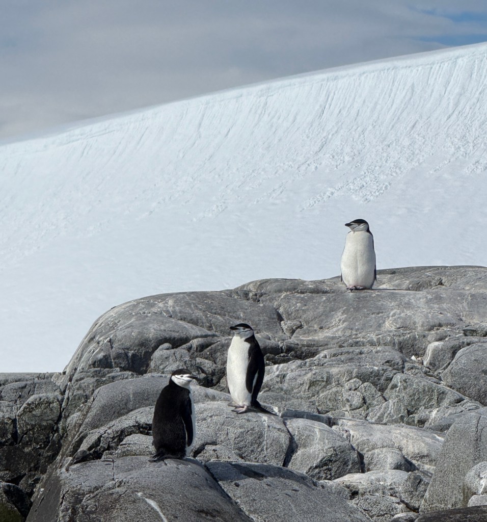
Above: I then happened upon my three favorite Chinstrap penguins who were up on a rock ledge while I was in the dingy. I stopped and contemplated their magnificence and thought to myself, “What a blessing and a privilege that I could have this private moment all to myself in this magical wonderland”. And then I turned around and….
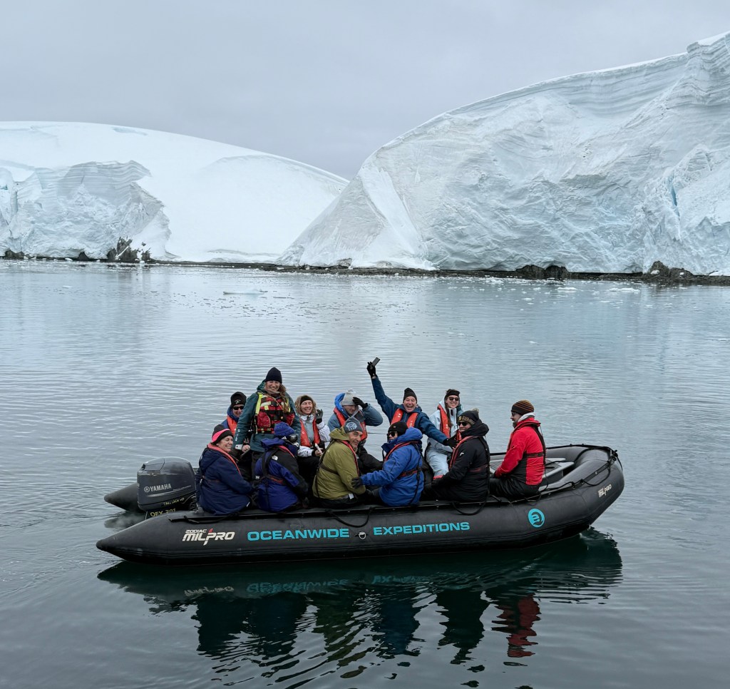
Yes, right behind me came a friendly dingy from a cruise ship that had anchored nearby (but out of our view) for the morning while they explored the Melchior Islands themselves. As soon as I left, they had their “private” time with the penguins.
Here we have the inherent juxtaposition and irony of the Antarctic. Incredible remote beauty and magnificent natural wonders. But I am sorry to say that the days of the lone explorer are over. Randall and I love the benefits and advantages of exploring the continent in a small/midsize sailboat. But as I just learned, we are not the only ones out here, so we all just need to share.
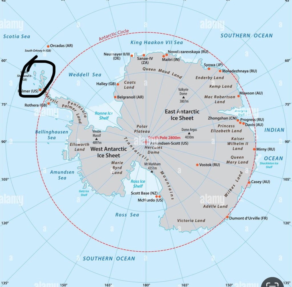
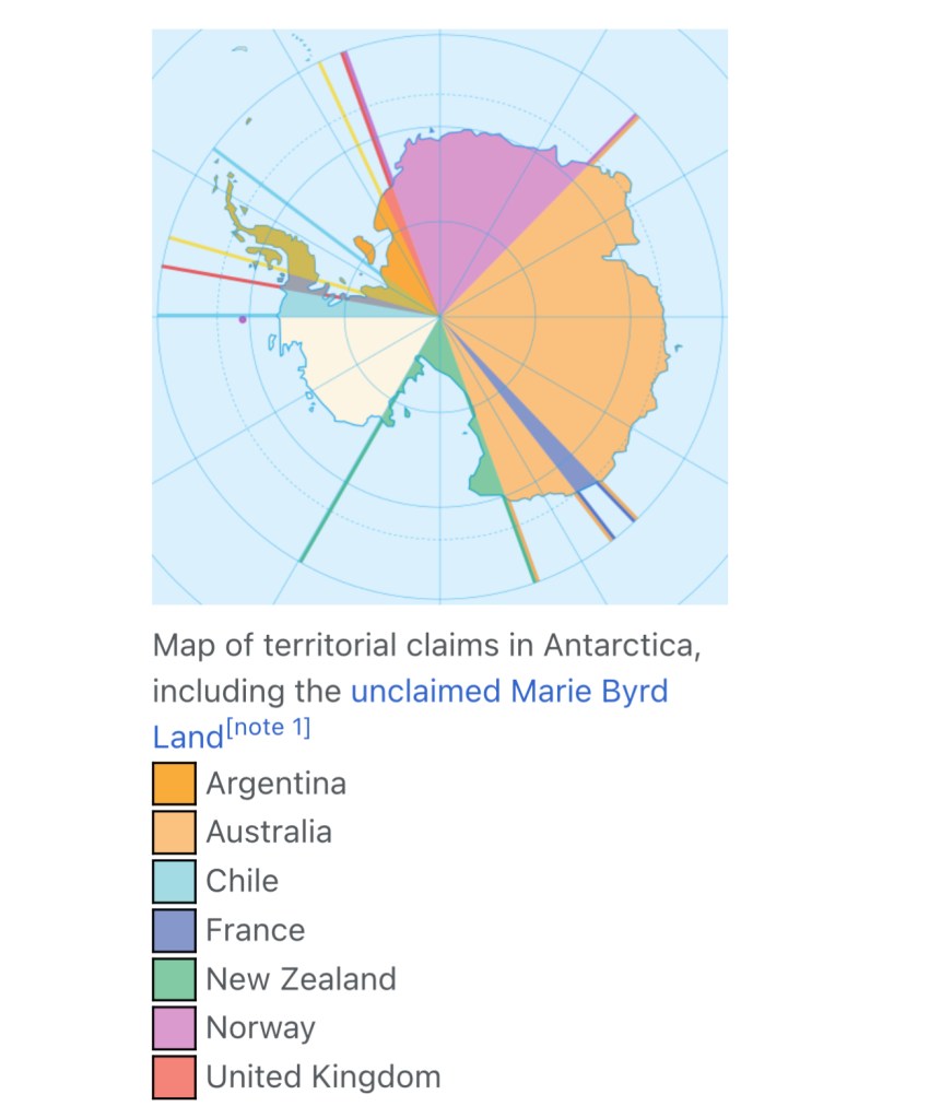
Who “owns” Antarctica?
Antarctica is not officially owned by any country, but it is divided into territorial claims by seven sovereign states, often referred to as “pie-slice” wedges converging at the South Pole. These claims were made in the first half of the 20th century and are currently held in abeyance (suspended) by the 1959 Antarctic Treaty, which prohibits new claims or the expansion of existing ones. The participating countries are: Australia (largest share), United Kingdom, Argentina, Chile, New Zealand, Norway and France.
The United States and Russia maintain a “basis of claim” and have not recognized the claims of other nations, nor have they made their own, but reserved the right to do so.
There are over 70 active research stations in Antarctica run by about 30 countries, with maybe 40 being permanent, year-round bases and the rest seasonal (summer-only) facilities, plus numerous smaller field camps, meaning the total number of operational sites is well over 100, though exact figures fluctuate. These stations support scientific research, with populations varying from around a total of 1,000 people in winter to over 4,000 in summer.
Randall and I had the privilege to visit a couple of these bases on our trip and they will be reported in following blogs.

Leave a reply to markbernstein8c066f7f41 Cancel reply